Plymouth City Walk
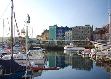
The walk begins on the Barbican. This is the oldest part of Plymouth, boasting among other things a 16th-century house, which dates from the time that the area was becoming the centre of the rapidly growing Plymouth. Note the memorial to the sailing of the Pilgrim Fathers in 1620. The piers have been rebuilt since those days, notably in the 1790s, although this rebuilding may well incorporate some of the pier which existed in 1620.
1. Start
Walk up the hill away from the Barbican, next to the sea. This is part of the South West Coast Path. The route is way-marked through Plymouth using white bands, often with a black acorn symbol, on lamp posts and by red metal signs. In the wall on the right look out for a Madonna, the patron saint of mariners, salvaged from a lost cargo of marble and a carved marble scallop shell, indicating that Plymouth was an official port of embarkation for pilgrims to the shrine of St James in Spain.
2. Citadel
Keep ahead as the path turns the corner to the right. Note the landmark on the pavement to the total eclipse of the sun which occurred in Plymouth in 1999. Above on the right are the walls of the Citadel, begun in 1666 by Charles II to defend Plymouth on the site of an earlier castle and fort. On the opposite side of the mouth of the Plym are Mount Batten and its breakwater. There was a settlement here in prehistoric times and more recently, in the 20th century it was a sea-plane base. The whole area has now been landscaped and is open to the public as a popular recreational area.
3. Smeaton’s Tower
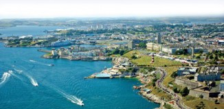
Keep ahead, still climbing slightly, to reach the Hoe where you can see Smeaton’s Tower. This is the lighthouse built on the Eddystone Rocks, 11 miles/18 miles offshore in 1750. It was re-erected on the Hoe in 1882 after being replaced with a new lighthouse. Continue past the renovated art deco Tinside Pool and the Colonnade. On the right is the large and ornate shelter dated 1891, built for the benefit of those taking the sea air in Victorian times.
4. West Hoe Pier
Walk past the little harbour of West Hoe Pier. The harbour, built in 1880, is a good vantage point to see Plymouth’s breakwater, sheltering the Sound from onshore gales. It was built by the famous engineer John Rennie between 1811 and 1841, and is said to have used 4.5 million tons of stone. As Grand Parade bears right, fork left along the footpath next to the sea.
5. Royal Navy Millennium Wall
Next to the path is the Royal Navy Millennium Wall, with representations of some of the Navy’s vessels. Behind is an imposing mid-19th century terrace, enjoying superb views over the Sound. At the end of the path turn left into Great Western Road and then ahead into West Hoe Road. On the left here is the ‘Wall of Industrial Memories’, a display of reclaimed and replica signs illustrating the rich industrial heritage of the Millbay Docks area.
6. Milbay Docks
At the next major junction turn left, along Millbay Road. Look out here for the “gold bullion” on the pavement. In the 1930s, gold was frequently sent from London to the United States via Millbay Docks, and bullion awaiting shipment could be seen here then. Cross the entrance road to the Ferry Port and continue ahead along Millbay Road. Millbay Docks were built in the 1840s. Now a ferry port for France and Spain, transatlantic liners used the docks until 1939. There was a direct rail link into the docks from London, used by some of the 20th-century’s most famous figures, as depicted on the ‘Wall of Stars’. Walking past the blue railings here, look for a famous order given by Sir John Hawkins to his fleet off Spain in 1564. It is only visible at certain angles.
7. Stonehouse
Continue along the rear of Millbay Docks, and then behind Stonehouse Royal Marine Barracks, along Caroline Place and Barrack Place. At a T-junction turn left into Durnford Street. Stonehouse was originally an individual town, separate from Plymouth. Although much bombed between 1939 and 1945, Durnford Street is the city’s most complete 18th-century road, originally laid out in 1775. The barracks were built between 1779 and 1785.
8. Artillery Tower
Continue past the main entrance to Stonehouse Barracks down Durnford Street. Towards the end of this street look out for quotations on the pavement from famous Sherlock Holmes detective stories. Their author Arthur Conan Doyle lived for a short time with a medical practice in this street. Pass St Paul’s Church then carry on ahead along a path on the left of the road, to arrive at a viewpoint by toilets and a refreshment kiosk. On the left is the Artillery Tower. Now a restaurant, the original tower was built in the 1480s, and then rebuilt in the 1530s by Henry VIII to protect Firestone Bay and the approach to Plymouth.
9. Royal William Yard
Turn sharp right here, past the “no access for unauthorised traffic” sign. This leads to the grand entrance of the Royal William Yard built in the 1820s by John Rennie (who also built the breakwater). It is regarded as the most remarkable example of an early 19th-century planned layout of industrial buildings anywhere in England. It was built as the Navy’s victualling yard in a classical style, impressive but functional. It included mills, bakery, brew house and slaughterhouse. Note the statue of William IV over the gate.
10. Ferry Stores
Go round the little roundabout and along Cremyll Street, passing the Victualling Office and Freeman’s Wharf. At the Ferry Stores turn left. You may have noticed what seem to be code words in the pavement along the route. The last one is here. They were used as a form of shorthand for communication by telegraph, one word standing for a whole phrase or sentence. Meanings were carried in the Nautical Telegraph Code Book. At the end of the road is the ferry point to Cremyll and Mount Edgcumbe in Cornwall, and is the end of the Coast Path in Devon.
Information
The walk: No stiles and completely flat terrain. A copy of the booklet Plymouth’s Waterfront Walkway, available in local TICs is recommended for this walk.
Parking: Head for city centre car parks and walk or take the bus to the start. The bus stop for the City Centre is at the top of the ferry access road, near the Ferry Stores.
Distance: Three miles


